While writing about some of the prefabs in Glasgow, I remembered that some had been on land which became the foundation for Sandyhills Park once they were razed.
However, that was not the end of the story, and the once attractive and well laid out park (complete with a keep-fit exercise route formed within its paths) was all but destroyed when almost half of it was buried under a later housing development.
While it’s not possible to go back and document or photograph the features which were lost under this development, it is still possible to see the scar along the edge of the park, which marks the line along which the park was cut, leaving the remains to the south, and the development to the north.
In the aerial view below, Lochay Street (which can be seen running west to east across the centre of the view) marks the most noticeable feature which marks the division between the park and the development. The rest of the reclaimed area is generally bordered by what was once the perimeter of the park. Ignoring the original tenements and a few other buildings which have been there since around 1900, all the modern houses that can be seen to the north and east are built on what used to be park, and date from the 1970s.
Other features, such as Sandyhills House which was also nearby, have been lost from the area in earlier developments, and are not related to this change. Interestingly, the lodge which belonged to Sandyhills House still survives, at the corner of Shettleston Road and Glen Ogle Street, having been converted into a modern dwelling.
Fortunately, I happened to be writing the prefab item in March, when there was little undergrowth on the various paths in the park, and the council has been clearing up the dead leaves, fallen branches, and other rubbish that had built up on the ground over winter, so the timing was pretty good to head down there for a walk, and take a few pics of the scar.
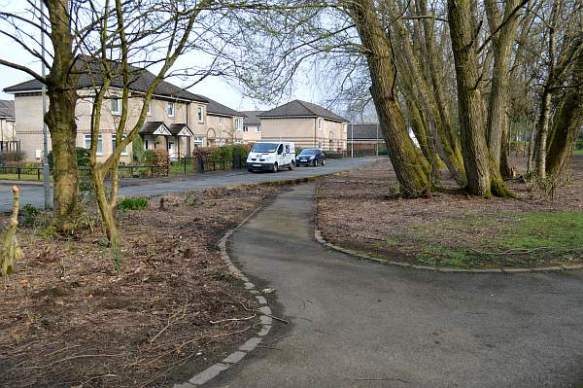
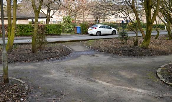
I’ve never really thought about it, but I guess anyone new to the area might think things look a little odd, as the paths that used to lead into the northern part of park were just cut off when Lochay Street was built over them, so appear to come to a sudden end for no reason, other than coming to the edge of the road, which looks a bit silly once you have noticed this.
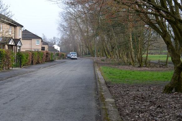
Sandyhills Park at Lochay Street cut
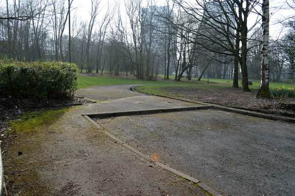
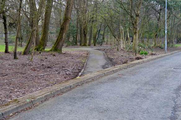
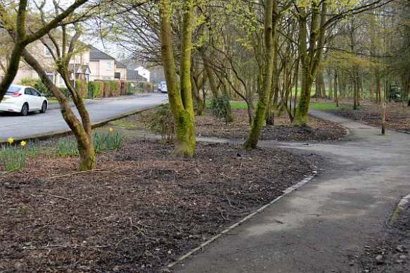
I’ve tried to show all the paths in the pics below, and how they just run into the edge of Lochay Street.
I used to think they might still lie under the road, but if we assume it was correctly constructed, then the paths would have been dug up as the proper foundation was prepared for the road.
Sandyhills Park Lochay St
Sandyhills Park Lochay St detail
Sandyhills Park Lochay St
Sandyhills Park Lochay St
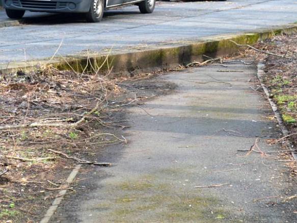
These are just a few more pics of the cut off detail:

Sandyhills Park Lochay St Cut

Sandyhills Park Lochay St Cut
Sandyhills Park Lochay St Cut
Sandyhills Park Lochay St Cut
